In order to ensure the highest quality of our services, we use small files called cookies. When using our website, the cookie files are downloaded onto your device. You can change the settings of your browser at any time. In addition, your use of our website is tantamount to your consent to the processing of your personal data provided by electronic means.

Other publications

List of English names of major geographical features situated in the territory of the Republic of Poland

The list of English names for major geographical features situated in the territory of the Republic of Poland has been prepared by the Commission on Standardization of Geographical Names outside the Republic of Poland, having in mind foreign authors who describe Poland in English. The list includes names of only those objects that are most likely to appear in foreign-language publications. These are the largest features, or those best known for their tourism value and historical significance: voivodships (provinces), major cities and towns, major historical regions, major landforms (geographical regions), major water features, national parks and other important sites. The list does not contain a complete list of features, it is limited primarily to forms that differ in English from Polish names, which in particular has reduced the number of locality names.

Materials

List of English names of major geographical features situated in the territory of the Republic of Poland
english​_names.pdf 0.14MB
Glossary of Terms for the Standardization of Geographical Names

“Glossary of Terms for the Standardization of Geographical Names” has been prepared by the UNGEGN Working Group on Toponymic Terminology, with Professor Naftali Kadmon as convenor and general editor of the publication. The Working Group developed “Glossary” in the English version – it was presented at the Seventh United Nations Conference on the Standardization of Geographical Names, held in New York on 13-22 January 1998. On the basis of this publication the first Polish translation was prepared. It was made by Jerzy Kondracki and issued by the Head Office of Geodesy and Cartography in 1998. In this Polish edition numerous changes and additions to the original English text were introduced.

In 2002, during the Eight United Nations Conference on the Standardization of Geographical Names, the next version of “Glossary” was presented, with entries in six official languages of the United Nations (with minor changes to the English text in relation to the 1998 edition). In 2007, the “Addendum” was published, in which some definition were changed and few terms were added.

This Polish edition of “Glossary of Terms for the Standardization of Geographical Names” is a new translation of the English version of “Glossary” from 2002, which was made by Marek Łukasik. No significant changes and additions were introduced to this edition in relation to the English version, as it had been done in the case of the first Polish translation of 1998 – the original wording of the definitions and descriptions of introduction notes were retained. “Glossary” consists 375 entries, out of which 237 are entries with definitions and 138 are cross-reference entries. Entries are numbered and arranged in alphabetical order with respect to the English terms, then their Polish counterparts are given (omitted, however, for the most cross-reference entries) and Polish translations of definitions. After the main dictionary body the Polish-English index of terms was placed. All this means, that in this way the arrangement adopted in the original “Glossary” for the other official languages of the UN (ie. French, Spanish, Russian, Chinese, and Arabic) was strictly preserved – therefore, the Polish version could be regarded as an extension of the UNGEGN “Glossary” for another language. The translation of “Addendum”, adopted by the UNGEGN in 2007, is also enclosed. In this addendum 6 definitions were changed as well as 17 new entries were added, which involve 8 entries with definitions and 9 cross-reference entries.

Materials

Glossary of Terms for the Standardization of Geographical Names
Glossary​_of​_Terms​_for​_the​_Standardization​_of​_Geographical​_Names.pdf 0.57MB
Original UNGEGN publication: Glossary of Terms for the Standardization of Geographical Names (Revised)
Glossary​_of​_terms​_revised.pdf 2.57MB
Archival Polish edition of “Glossary”: Słownik terminów używanych przy standaryzacji nazw geograficznych (1998)
Glossary​_of​_Terms​_for​_the​_Standardization​_of​_Geographical​_Names​_1998.pdf 1.97MB
The Great Toponymic Divide. Reflections on the definition and usage of endonyms and exonyms

The Great Toponymic Divide

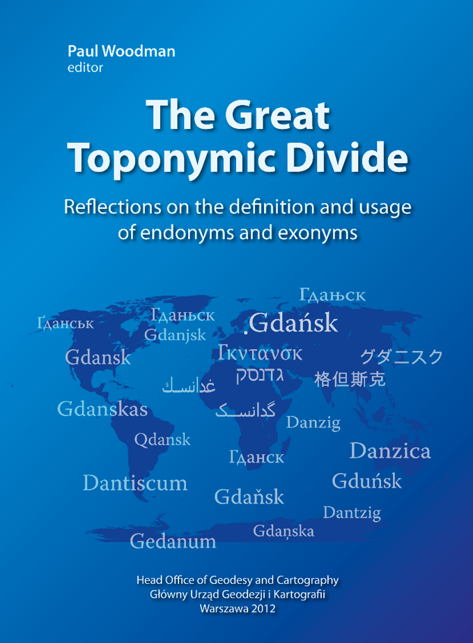
Paul Woodman (editor), published by Head Office of Geodesy and Cartography in 2012.

The book contains papers presented at the 12th Meeting of the UNGEGN Working Group on Exonyms in Gdańsk, Poland, in May 2012 plus one hitherto unpublished paper from the Working Group’s eleventh session, held in Vienna in May 2011. The papers deal with the endonym/exonym divide (“The Great Toponymic Divide”), exonym analysis and usage, endonyms and exonyms in minority language environments, and an endonym/exonym illustration from history.

Contents:

Section I – The endonym/exonym divide

Paul Woodman • The naming process: Societal acceptance and the endonym definition
Peter Jordan • Towards a comprehensive view at the endonym/exonym divide
Philip W. Matthews • Endonyms, exonyms and seas
Ojārs Bušs • On some possibilities for a more exact definition of exonyms
Paul Woodman • Endonyms, exonyms and language boundaries: A clarification
Maciej Zych • Definition of ‘exonym’ in the context of the new list of Polish exonyms
Herman Bell • Nubian perceptions of exonyms and endonyms
Halīm Sabbār • Numbers as geographical names in Nubia: Endonyms or exonyms?
Paul Woodman • Toponymic expression: Endonyms and exonyms in speech, writing and reading

Section II – Exonym analysis and usage

Małgorzata Mandola • French exonyms for Polish toponyms
Béla Pokoly • Trends in exonym use: Selected exonyms of the Hungarian language
Maria Del Mar Batlle • What is an endonym in Spain?
Bogusław R. Zagórski • Polish exonyms for the Arab world: How they come and go; what appears to stay
Ivana Crljenko • Geographical feature importance as a criterion for exonym selection: Croatian examples
Pavel Boháč • Names of European spatial features within the List of Czech Exonyms

Section III – Minority toponyms

Zsombor Bartos-Elekes • Minority toponyms in Romania
Mónika Mándoki, András Dutkó • Slovak names of settlements in Hungary
Ewa Wolnicz-Pawłowska, Maciej Zych • Place names in minority languages in Poland

Section IV – Endonyms, exonyms and an illustration from history

Paul Woodman • Toponymy in a landscape of aggression: Geographical names in National Socialist Germany


Materials

The Great Toponymic Divide. Reflections on the definition and usage of endonyms and exonyms
The​_great​_toponymic​_divide.pdf 24.47MB
Geographical names of the world

In 2002 the Commission on Standardization of Geographical Names Outside the Republic of Poland started to work on Nazewnictwo geograficzne świata (Geographical Names of the World) developed by a large group of specialists: geographers, historians, linguists and cartographers. As work progresses, volumes with the names of separate regions of the world are published.

The lists include two types of names – Polish exonyms and endonyms. The Commission on Standardization of Geographical Names Outside the Republic of Poland standardizes exclusively Polish names without handling the standardization of endonyms, and the exonyms included in the lists are the only Polish names recommended by the Commission – the absence of an exonym for a feature is tantamount to stating that the Commission recommends no Polish name for it, even if that name can be found in some publications, and the only recommended form is the original name. For names in the languages using a non-Roman alphabet the romanized form has been provided in accordance with the rules recommended by the Commission, to be applied in Poland for geographical names from a specific language. In the case of the majority of such languages, both Polish transcription form and transliteration form have been provided.

The list includes the names of geographical features which, solely from the linguistic point of view, were considered by the Commission to be correct and in line with the knowledge gathered so far. In no case do these recommendations have anything in common with the Commission taking any stand on political matters or those relating to administrative status of each territory. Any stands on political issues, if they have to be taken, are always consulted with the Ministry of Foreign Affairs.

  • Geographical names of the world. Volume 1. Americas, Australia and Oceania
    The list has been published in 2004. It contains the names of app. 5500 geographical features from 89 countries and non-self-governing territories with Polish exonyms for features which have them.
  • Geographical names of the world. Volume 2. Middle East
    The list has been published in 2004. It contains the names of app. 3900 geographical features from 20 countries and non-self-governing territories.
  • Geographical names of the world. Volume 3. Africa
    The list has been published in 2004. It contains the names of app. 7100 geographical features from 58 countries and non-self-governing territories.
  • Geographical names of the world. Volume 4. South Asia
    The list has been published in 2005. It contains the names of app. 3800 geographical features from 7 countries.
  • Geographical names of the world. Volume 5. Central Asia and Transcaucasia
    The list has been published in 2005. It contains the names of app. 4300 geographical features from 10 countries. It also contains romanization tables for 11 languages.
  • Geographical names of the world. Volume 6. Belarus, Russia, Ukraine
    The list has been published in 2005. It contains the names of app. 2900 geographical features from 3 countries. It also contains romanization tables for 3 languages.
  • Geographical names of the world. Volume 7. Southeast Asia
    The list has been published in 2006. It contains the names of app. 5100 geographical features from 14 countries and non-self-governing territories. It also contains romanization tables for 4 languages.
  • Geographical names of the world. Volume 8. The Antarctic
    The list has been published in 2006. It contains the names of app. 1100 geographical features from Antarctica and the surrounding islands. Additionally, the publication contains the index of all geographical names given by Polish expeditions beginning from 1978.
  • Geographical names of the world. Volume 9. East Asia
    The list has been published in 2006. It contains the names of app. 4500 geographical features from 6 countries. It also contains romanization tables for 5 languages.
  • Geographical names of the world. Volume 10. Seas and oceans
    The list has been published in 2008. It contains app. 1700 names of seas and their parts as well as of the forms of their beds.
  • Geographical names of the world. Volume 11. Europe. Part I
    The list has been published in 2009. It contains the names of app. 9200 geographical features from 21 countries. It also contains romanization tables for 8 languages.
  • Geographical names of the world. Volume 12. Europe. Part II
    The list has been published in 2010. It contains the names of app. 8200 geographical features from 30 countries.

Materials

Geographical names of the world. Vol. 1. Americas, Australia and Oceania
Geographical​_names​_of​_the​_world​_Vol​_1​_Americas,​_Australia​_and​_Oceania.pdf 1.38MB
Geographical names of the world. Vol. 2. Middle East
Geographical​_names​_of​_the​_world​_Vol​_2​_Middle​_East.pdf 0.91MB
Geographical names of the world. Vol. 3. Africa
Geographical​_names​_of​_the​_world​_Vol​_3​_Africa.pdf 2.36MB
Geographical names of the world. Vol. 4. South Asia
Geographical​_names​_of​_the​_world​_Vol​_4​_South​_Asia.pdf 0.98MB
Geographical names of the world. Vol. 5. Central Asia and Transcaucasia
Geographical​_names​_of​_the​_world​_Vol​_5​_Central​_Asia​_and​_Transcaucasia.pdf 1.19MB
Geographical names of the world. Vol. 6. Belarus, Russia, Ukraine
Geographical​_names​_of​_the​_world​_Vol​_6​_Belarus,​_Russia,​_Ukraine.pdf 0.79MB
Geographical names of the world. Vol. 7. Southeast Asia
Geographical​_names​_of​_the​_world​_Vol​_7​_Southeast​_Asia.pdf 0.97MB
Geographical names of the world. Vol. 8. The Antarctic
Geographical​_names​_of​_the​_world​_Vol​_8​_The​_Antarctic.pdf 0.51MB
Geographical names of the world. Vol. 9. East Asia
Geographical​_names​_of​_the​_world​_Vol​_9​_East​_Asia.pdf 0.92MB
Geographical names of the world. Vol. 10. Seas and oceans
Geographical​_names​_of​_the​_world​_Vol​_10​_Seas​_and​_oceans.pdf 1.00MB
Geographical names of the world. Vol. 11. Europe. Part I
Geographical​_names​_of​_the​_world​_Vol​_11​_Europe​_Part​_I.pdf 1.34MB
Geographical names of the world. Volume 12. Europe. Part II
Geographical​_names​_of​_the​_world​_Vol​_12​_Europe​_Part​_II.pdf 2.56MB
Collecting and elaborating geographical names. Toponymic Guide

Publication "Collecting and elaborating of geographical names. Toponymic guide" (Zbieranie i opracowywanie nazw geograficznych. Przewodnik toponimiczny) was issued as an initiative of the Head Office of Geodesy and Cartography. Its aim is to describe methods of collecting and establishing standardized forms of geographical names and ways of its presention on the maps.

Part 1. Collecting Names in the Field

64-page first part of toponymic guide, published in 2002, concerns methods of collecting in the field own names of features, permanently related to Earth surface. Terms and basic notions concerning collection and preparation of names were presented in this part. Preparatory works were described here: their scope, usage of existing sets of names and communication with name users. Field works were discussed: their range, field inquiry and name recording. Also way of determining type of feature, its location and preparation of list of names was presented. Sample letters to offices of commune, city and forest district, copies of names, list of abbreviations of information sources, exemplary list of names and definitions of the selected topographic features were included in the appendices.

Part 1. Collecting Names in the Field


Part 2. Language elaboration of names

Second part of toponymic guide, published in 2003, characterizes geographical names as a part of Polish language. Rules of Polish spelling of geographical names, discussed here, were divided into names of geographical features, which are located in Poland and those which are situated in neighboring countries. For first group of names rules of using capital and small letters were given, rules of writing with hyphen and writing adjectives derived from two-word geographical names were given. For geographical names of features situated in neighboring countries rules of local spelling were characterized and lists of alphabets used in these countries were given, namely: Czech, Lithuanian, German, Lower-Sorbian, Upper- Sorbian, Slovakian, Belarussian, Russian and Ukrainian. Also rules of transcription and transliteration were given for last three alphabets. The separate chapter, illustrated with 14 maps, was dedicated to dialects of Polish language. Authors included in publication the glossary of old topographic terms, which are no more used in literary language, but can be still found in geographical names, as well as list of abbreviations existing on maps and in their legends.

przewodnik toponimiczny część II

Part 3. Applying and arranging scripts on maps

In third part of toponymic guide, published in 2004, characterization of geographical names and other scripts, as an integral part of a map, was presented. Functions and types of scripts on maps were described, writing system used in cartography was characterized. After presentation of general rules of applying scripts on maps the detailed rules of locating names related to point, linear and area features were discussed. Location of names of particular map elements was described in details – large chapter is related to names of localities and their parts, both on topographic and on tourist, small-scale and atlas maps. Similar description was included for rules of placing names of streets and scripts concerning constructions and devices on topographic maps and city plans, names of spatial division (countries, regions, parks), names of water bodies (hydronyms) and names of relief forms (oronyms). Also general rules of preparation of gazetteers were described. The publication is richly illustrated with map reproductions presenting both correct and erroneous placement of names.

przewodnik toponimiczny część III

{"register":{"columns":[]}}