New data on the radiation map of Poland
05.01.2023
We are developing a map of the country's radiation situation - from now on, the map portal publishes the results of measurements of the ionizing radiation level of thirteen new PMS stations belonging to the PAA, as well as the results provided by the stations of the Institute of Meteorology and Water Management.
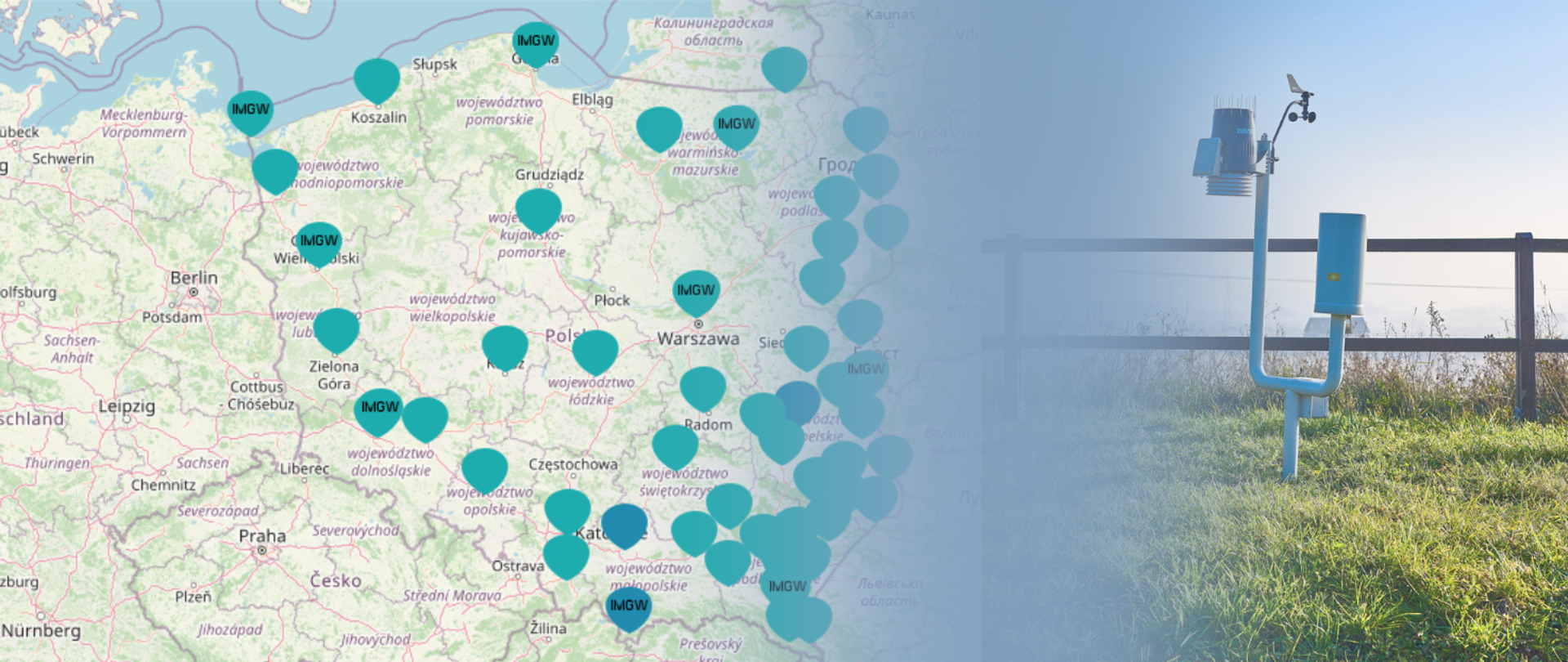
As previously announced, we are adding new values to the map of the radiation situation in the country. From now on, anyone interested can read the indications of the PMS (Permanent Monitoring Station) station for early detection of radioactive contamination, owned by IMGW. The stations of the Institute of Meteorology and Water Management are located in nine locations: in Warsaw, Mikołajki, Gdynia, Świnoujście, Gorzów Wielkopolski, Legnica, Zakopane, Lesko and in Włodawa and carry out measurements commissioned by the Chief Inspectorate of Environmental Protection as part of the State Environmental Monitoring. In addition, the results provided by 13 new PAA stations have also appeared on the map.
In order to see the indications of individual stations, it is enough to expand "PMS stations", "IMMW stations" in the "Early radioactive contamination detection stations" window and then select "Dose rate". PAA PMS stations are marked with blue dots, while IMGW devices are marked with blue dots with the inscription IMGW.
Those interested can use the available, various map backgrounds, which are to help in obtaining as complete spatial information as possible. The results of IMGW station measurements can be interpreted analogously to the results published for PAA stations.
How to read the radiation map of Poland?
The results of each PMS measurement shown on the map are provided in nanosieverts per hour (nSv/h). The readings differ by location and local conditions (terrain, geological structure etc.).
In most cases, the stations installed as part of Poland’s radiation monitoring show the values below 0.1 µSv/h. Single devices record the dose rate of more than 0.1 µSv/h in dry weather. During rain, especially preceded by a long period of drought, a natural background of ionising radiation may temporarily rise to 0.2 µSv/h, and in certain cases even to almost 0.3 µSv/h.
Important! These values are within normal range and should not give rise to concerns.
The value exceeding 0.3 µSv/h in Poland requires verification of the source of elevated radiation levels. Let us not forget that in many places across Europe 0.3 µSv/h is a natural background. Should the radiation exceed the normal range, PAA will issue a relevant statement. Currently, the radiation situation is within normal range – there is no risk to human health and life and the environment. The Agency continuously monitors the radiation situation in Poland– 24/7.