SAFEDAM
The SAFEDAM system for precise monitoring of levees, e.g. by using drones. In crisis situations, it may save human lives

 Project title
Advanced technologies supporting the prevention of flood-related hazards
 Name of Beneficiary/Beneficiaries
- Warsaw University of Technology, Faculty of Geodesy and Cartography – the Consortium Leader
- Institute of Meteorology and Water Management – National Research Institute – a Consortium Member
- Astri Polska Sp. z o.o. – a Consortium Member
- MSP INNTECH Sp. z o.o. – a Consortium Member
- Central School of the State Fire Service in Częstochowa – a Consortium Member
 Name of programme
THE SECURITY AND DEFENCE PROGRAMME
 Competition
A competition for developing R&D projects in the field of state security and defence
 Project value
PLN 8,586,515.00
 Funding value
PLN 8,448,215.00
 Project delivery period
22 December 2015 – 21 May 2020
Meet our team
View the results of our work
See also: www.safedam.gik.pw.edu.pl
What problem is addressed by the project?
In Poland, there are thousands of kilometres of levees. The traditional monitoring of their condition involves taking direct geodesic measurements every couple hundred metres. In contrast, a detailed analysis of the condition of flood defences can save the lives and property of thousands of people. SAFEDAM, which operates from the air, makes it possible to analyse the condition of each square metre of the levee!
Spatial information and data for a detailed analysis of the condition of flood defences are essential for security purposes. Our system is a revolutionary solution for levee monitoring and rescue action coordination in the event of a flood.
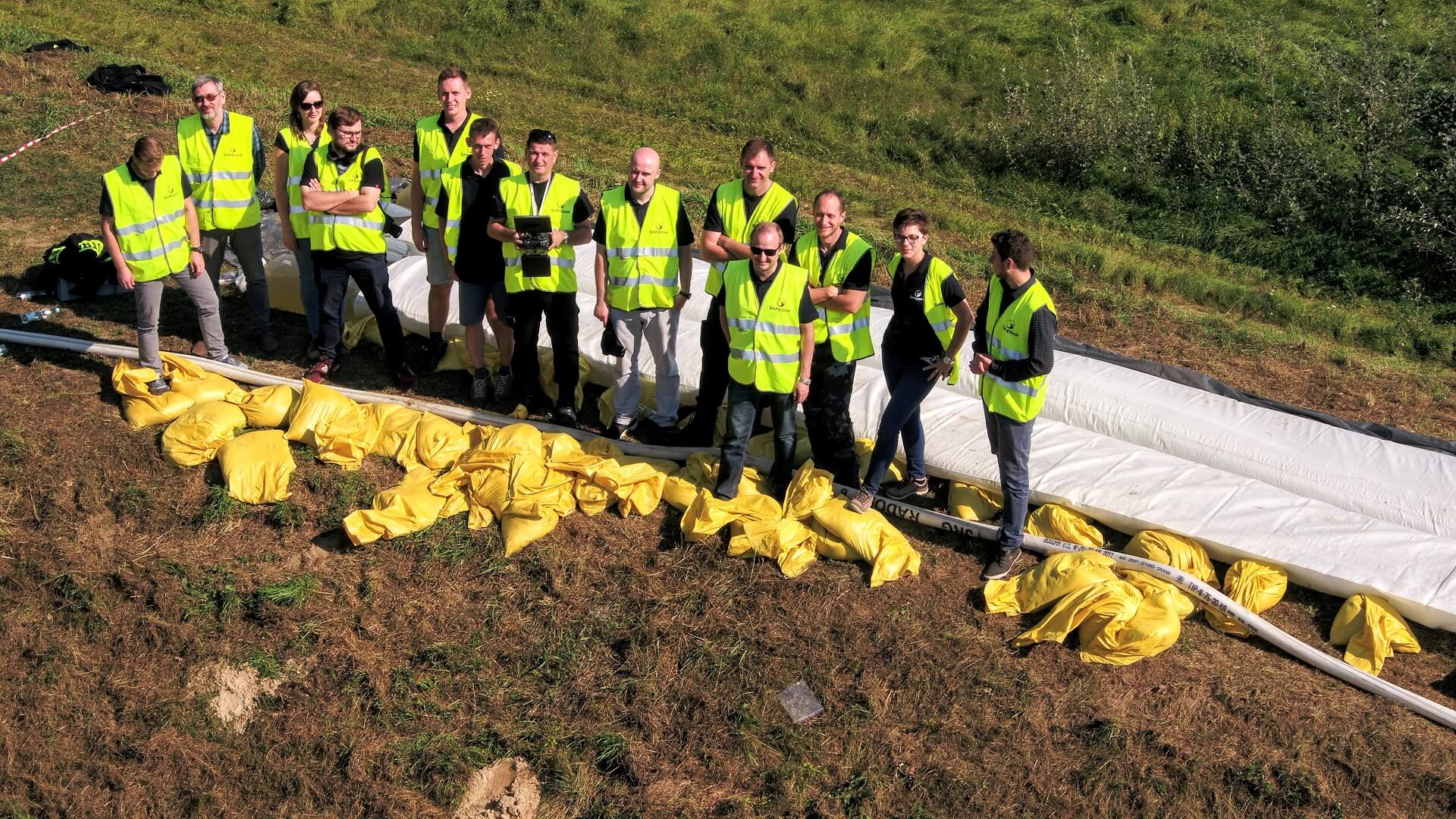
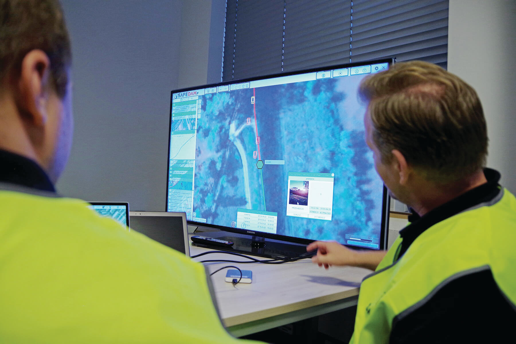
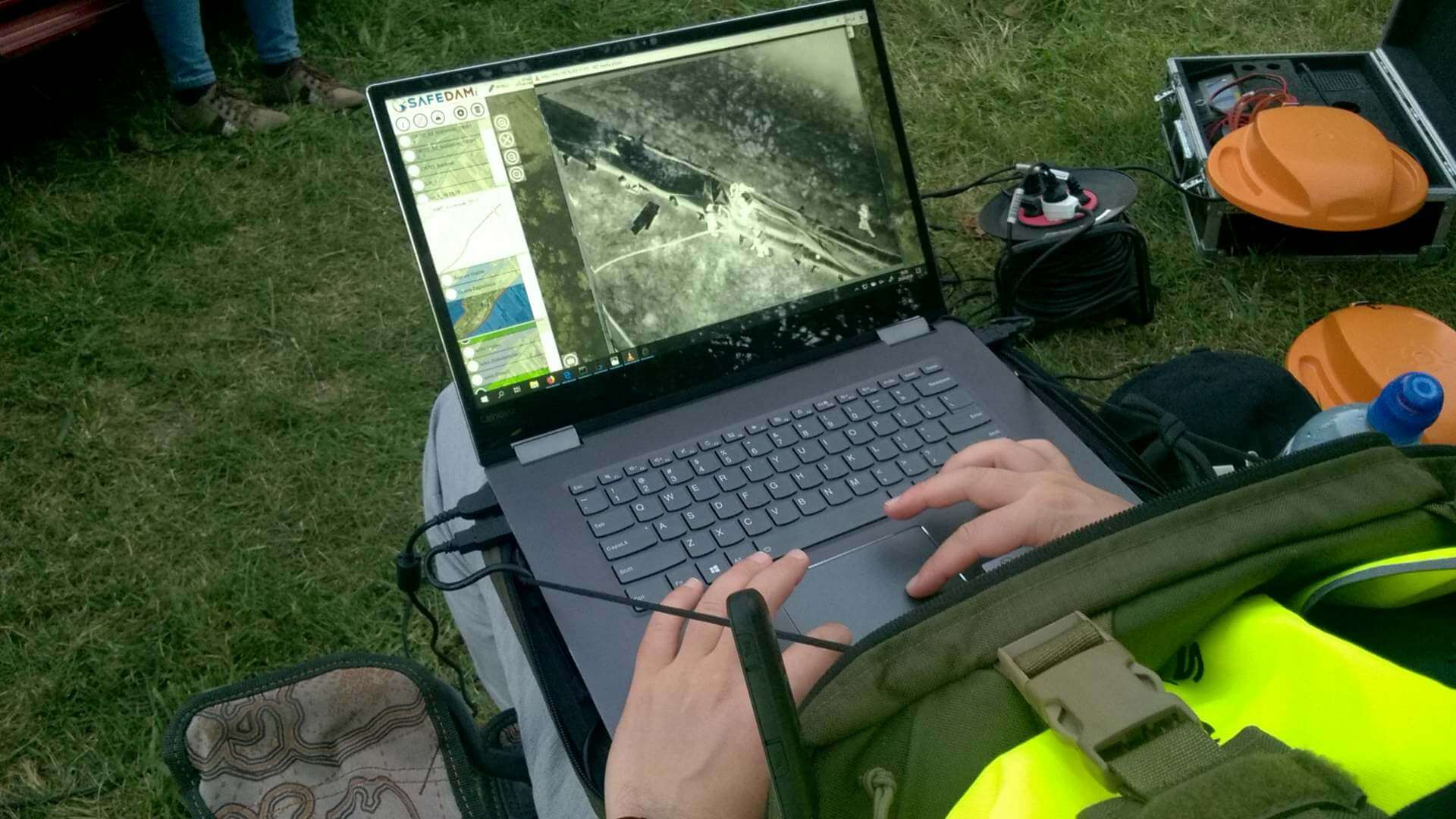
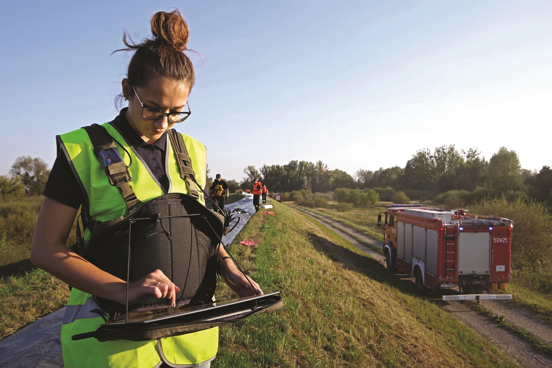
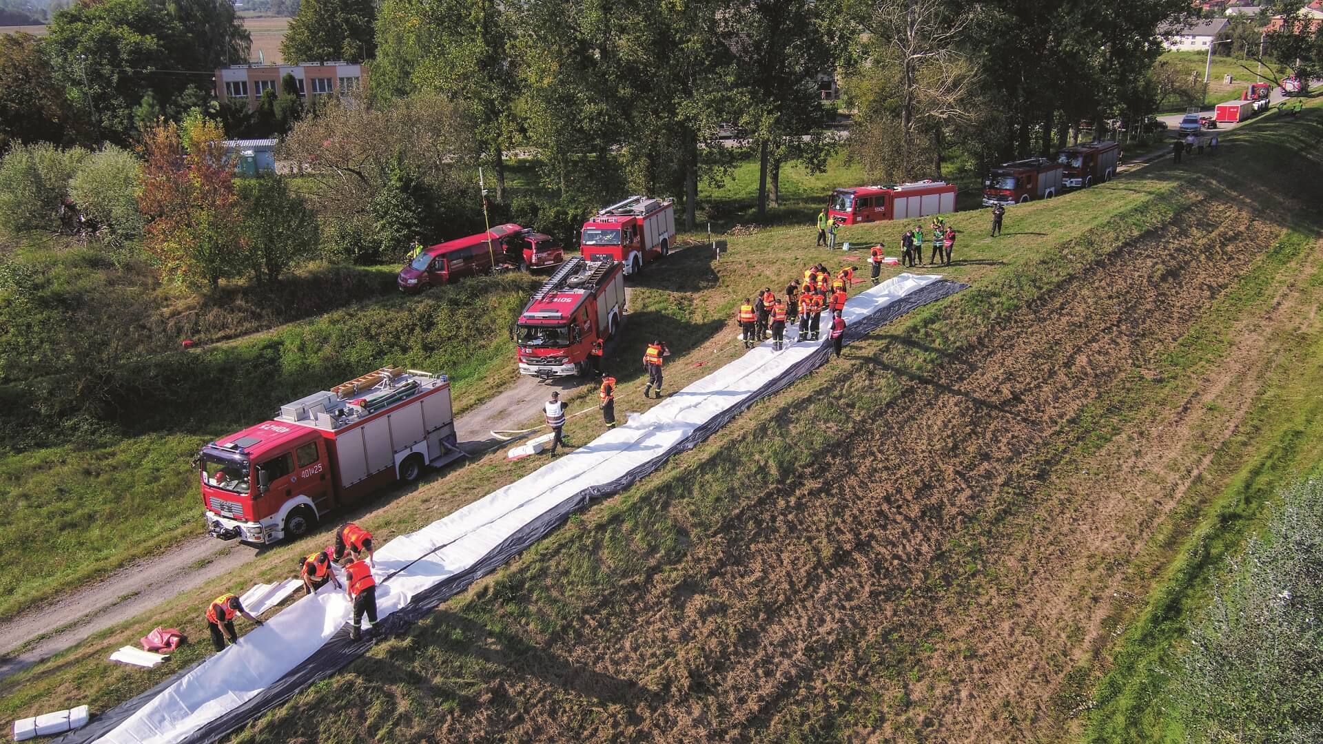
Let us explain it in detail. The SAFEDAM project involves the preparation of a system monitoring levees much more precisely than before. The monitoring is performed by unmanned aerial systems and aerial and satellite data. Most importantly, levee trouble spots can be measured with an accuracy of up to several centimetres thanks to the use of a laser scanner and photogrammetric data. 3D data obtained in this way are automatically analysed under the supervision of hydrological services and used for creating visualisations for the State Fire Services and crisis management experts. We can provide precise information regarding the condition of various defences, driven by the assumption that preventing potential fortuitous events is always the best option.
SAFEDAM has two configurations: preventive – involving the acquisition of data to monitor flood defences, and interventional – supporting the services in threat situations and during floods. Thanks to that, the services can identify precisely where the probability of a crisis is the highest, and which locations are at the greatest risk – in other words, where taking protection and rescue measures is or will be required.
Who uses the project results?
Our IT solution was based on the opinions of experts dealing with levee management and measurement, and with rescue operations. We are convinced that our project will be a breakthrough and will prove useful for the State Fire Services, and also, if interested, for local authorities and crisis management units throughout Poland.
The geoparticipation module constitutes an essential part of the system, engaging communities in flood control measures. With the integration of their mobile devices, people will be able to send notifications on the condition of levees in the country, and the system will gather much more information. In the event of a flood, the system will help the services coordinate actions, pointing to locations where the risk of levee failure is the highest.
What was the greatest challenge during project implementation?
Our greatest challenge during project implementation was to meet the requirements of numerous end users – consignees of the developed solution. Both their competences and needs were so different that we decided to de facto establish two system configurations integrated with each other, but with different functionalities. Developing a concept for such a solution, linked through various modules, proved to be as challenging as the organisation of independent field exercises or participation in those held by the State Fire Services. These were altogether attended by hundreds of fire-fighters whose work we could monitor.
Our advice for other applicants
Do not fear to create bold visions of innovative solutions that can be co-funded by Polish units.